
Καιρικές Συνθήκες Κυριακής 31 Αυγούστου
Η Κυριακή (31/8) ξεκίνησε με βροχές και καταιγίδες σε πολλές περιοχές της δυτικής και βόρειας Ελλάδας. Η Εθνική Μετεωρολογική Υπηρεσία (ΕΜΥ) είχε προειδοποιήσει από το Σάββατο (30/8) για έντονα φαινόμενα κυρίως σε Κέρκυρα, Παξούς και Ήπειρο. Στην υπόλοιπη χώρα, ωστόσο, ο καιρός αναμένεται πιο ήπιος με γενικά αίθριο ουρανό και θερμοκρασίες που θα αγγίξουν τους 34-35 βαθμούς Κελσίου.
Πρόγνωση Καιρού από την ΕΜΥ
Στη δυτική και βόρεια Ελλάδα αναμένονται νεφώσεις με τοπικές βροχές και σποραδικές καταιγίδες κατά τις πρώτες πρωινές ώρες της Κυριακής (31/8), κυρίως στις περιοχές της Κέρκυρας, των Παξών και της Ηπείρου. Από το απόγευμα προβλέπεται σταδιακή βελτίωση του καιρού.
Στις υπόλοιπες περιοχές της χώρας ο ουρανός θα είναι γενικά καθαρός με πρόσκαιρες νεφώσεις στα ηπειρωτικά μέχρι το απόγευμα, όπου θα σημειωθούν κάποιες τοπικές βροχές. Οι άνεμοι θα πνέουν νότιοι-νοτιοδυτικοί εντάσεως 3 έως 5 μποφόρ, ενώ στο νότιο Αιγαίο μπορεί να φτάσουν τα 6 μποφόρ. Από το μεσημέρι οι άνεμοι στα δυτικά θα στραφούν σε βορειοδυτικούς εντάσεως 4 έως 5 μποφόρ.
Η θερμοκρασία αναμένεται να υποχωρήσει στα δυτικά και τα βόρεια τμήματα: συγκεκριμένα στους 30-32 βαθμούς Κελσίου στην περιοχή του Ιονίου καθώς επίσης στους υπόλοιπους ηπειρωτικούς χώρους στους 34-35 βαθμούς Κελσίου.
Αττική
- Καιρός: Γενικά αίθριος με λίγες νεφώσεις.
- Άνεμοι: Δυτικών διευθύνσεων εντάσεως 3 έως 4 μποφόρ, τοπικά έως 5 μποφόρ.
- Θερμοκρασία: Από 21 έως 33 βαθμούς Κελσίου.
Θεσσαλονίκη
- Καιρός:Nεφώσεις με πιθανές βροχοπτώσεις τις πρωινές ώρες – Βελτίωση του κλίματος από νωρίς το απόγευμα.
- Άνεμοι:: Μεταβλητοί εντάσεως περίπου 2 έως 3 μποφόρ.
- Θερμοκρασία:: Από19 έως31 βαθμούς Κελσίου.
Mακεδονία – Θράκη
- < strong > Καιρός: Στα δυτικά , λίγα σύννεφα που κατά τη διάρκεια του μεσημεριού μπορεί να αυξηθούν , προκαλώντας πιθανές κατακρημνίσεις στις ορεινές ζώνες – Σε άλλες περιοχές , οι νεφώσεις αρχικά στην κεντρική Μακεδονία , στη συνέχεια αυξημένες σε άλλες ζώνες , όπου μπορεί να εκδηλωθούν καταιγίδες – Αναμένοντας μια σταδιακή αποκατάσταση του κλίματος νωρίς την απογεύματα στη Μακεδονία κι αργότερα στη Θράκη .
- < strong > Άνεμοι: Νότια διεύθυνση μεταξύ2και4μποφόρων .
- < strong > Θερμοκρασία: Από18έως32βαθμούςCelsius – Στη Δυτική Μακεδονίαθα είναι χαμηλότερη κατά23βαθμούςCelsius .
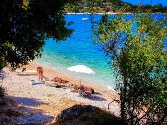
Nησιά Ιόνιο – Ήπειρος – Δυτική Στερεά – Δυτική Πελοπόννησος
- < strong > Καιρός: Παροδικά αυξημένες νεφώσειςμεπιθανότητεςβροχώνκαικαταιγιδογεννήσειςστις πρωινές ώρες – Τα φαινόμεναθα είναι ισχυράστιςπεριοχείςτηςΚέρκυραςΠαξώνκαιΉπειρου – Βελτίωσητουκαιρούαναμένονταςαπότοαπόγεμα .
< / li > - < strong > Άνεμος : Αρχικώς νοτιοδυτικοί μεταξύ των τριών τεσσάρων μπόφορ κι αργότερα μετατραπήσουν σε βορείους ανάμεσα στο τρία τέσσερα μπόφορ στο Ιόνιο πέντε μπόφορ .
< / li > - < Strong temperature : From19to32degreesCelsius–InEpirusandIonianitwillbe2to3degreeslower.
< / Li >
The Thessaly – Eastern Sterea – Evia – Eastern Peloponnese
< / h4 >-
< Li >< strong weather : A few clouds with local rains in the morning in the northern parts adn in the afternoon in the Peloponnese.
< / Li >
- The general atmosphere is clear.
winds :Southeast winds of four to five boffors.
Thermometer :A range from twenty-two to thirty-two degrees Celsius. - The general atmosphere is clear.
winds :Southern winds of four to five and up to five boffors from western directions in Dodecanese.
Thermometer :A range from twenty-two to thirty-two degrees Celsius.
< Li >< Strong winds : Westerners between four and five and locally six boffors to the south. < / Li >
< Li >< Strong temperature : From eighteen to thirty-five degrees Celsius. < / Li >
Cyclades-Crete
Eastern Aegean Islands-Dodecanese
The forecast for Sunday (31/8) indicates that many areas of western central and northern Greece will experience rain showers and thunderstorms with some intensity accompanied by hail at times. Though, as early as morning hours there will be an improvement in conditions with a cessation of phenomena by noon across all mentioned regions. There will also be increased concentrations of african dust present in the atmosphere but this will subside by afternoon hours.
The temperatures are expected to vary between fourteen and twenty-eight degrees Celsius for western Macedonia; fifteen up until thirty or thirty-two for other parts; while central Greece may see temperatures ranging from twenty-one up until thirty-four or even six; meanwhile Epirus can expect a range between nineteen through twenty-eight; other mainland areas should see values ranging from eighteen through thirty-four or even higher at eastern locations reaching around thirty-five or six.
Winds over southern Aegean regions are expected predominantly westerly at speeds reaching four-to-five boffors locally peaking at six while southern Aegean sees southerly breezes hitting speeds nearing five boffors.Accordingly according meteo.gr forecasts northwestern winds blowing across Ionian Sea should reach levels around four-to-five while Corinth Gulf experiences stronger currents averaging about five-to-six boffor strength.
In Attica region including Athens city itself we anticipate partly cloudy skies where westerlies could reach speeds nearing four-boffers locally peaking towards higher ranges within it’s westernmost sections possibly hitting levels approaching six-boffers too whilst temperatures hover around ranges spanning anywhere between twentythree upwards towards mid-thirties degree celsius marks respectively.
Finally regarding Thessaloniki we expect rainfall along with possible thunderstorms which might intensify further accompanied occasionally by hail but improving conditions anticipated later during afternoons ahead where northwesterlies blow steadily maintaining average strengths hovering three-fourboffers throughout day’s course alongside thermometric readings fluctuating anywhere within low twenties extending upwards into thirties degree celsius brackets overall!
- The general atmosphere is clear.
- < strong > Καιρός: Παροδικά αυξημένες νεφώσειςμεπιθανότητεςβροχώνκαικαταιγιδογεννήσειςστις πρωινές ώρες – Τα φαινόμεναθα είναι ισχυράστιςπεριοχείςτηςΚέρκυραςΠαξώνκαιΉπειρου – Βελτίωσητουκαιρούαναμένονταςαπότοαπόγεμα .